


Event
2026.04.21 Tue
【Event Report】“GPM/PMM Asia-Oceania Workshop 2026” Held in the Philippines
The Japan Aerospace Exploration Agency (JAXA), in collaboration with the Philippine Atmospheric, Geophysical and Astronomical Services Administration (PAGASA) under the Department of Science and Technology (DOST), and the University of the Philippines – Institute of Environmental Science and Meteorology (UP-IESM), held the “Global Precipitation Measurement (GPM) / Precipitation Measuring Mission (PMM) Asia-Oceania Workshop 2026” on March 26 and 27, 2026 at UP-IESM in Quezon City, Philippines.
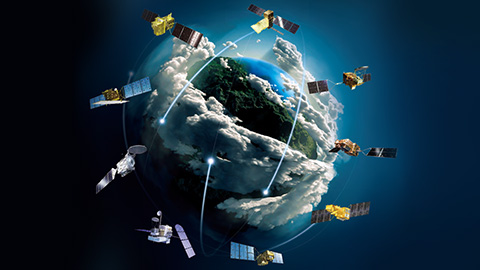
Approximately 100 participants from 12 countries across the Asia–Oceania region attended the workshop. A total of 40 presentations were given, including reports on research utilizing precipitation products such as the Global Satellite Mapping of Precipitation (GSMaP) derived from the satellites including the Global Precipitation Measurement (GPM) core satellite, as well as presentations on the next-generation precipitation radar satellite Precipitation Measuring Mission (PMM) currently under development. The workshop featured active discussions among participants.

In the opening session, a welcome speech was delivered by Dr. Nathaniel Servando, Administrator of PAGASA. He welcomed participants from across Asia-Oceania region and expressed expectations for the use of satellite data in water resource management and disaster risk assessment, as well as for the promotion of collaboration among related organizations through this workshop.

This was followed by opening remarks from Mr. Osamu Ochiai, Director of the Earth Observation Research Center (EORC) at JAXA. He noted that cooperation between Japan and the Philippines has been steadily strengthening and that this workshop represents part of that ongoing collaboration. He also expressed expectations that the long-term observations of the GPM Core Observatory and the utilization of precipitation observation data, including those from the PMM satellite currently being developed by JAXA, will further strengthen cooperation across the Asia–Oceania region.
In addition, JAXA introduced the GPM/PMM missions, the MIZU Initiative and an overview of Sentinel Asia. Mr. Kenji Akaeda from JICA reported on the usefulness of GSMaP in countries and regions where ground-based observation infrastructure is insufficient.
During the workshop, a wide range of activities across the Asia–Oceania region was shared, focusing on satellite-based precipitation data, from research and technological development to operational applications and disaster risk reduction. The following presentations and discussions were held.
■ Expansion of Operational Use and Advancement of Scientific Knowledge in the Asia–Oceania Region
It was highlighted that satellite-based precipitation data, including GSMaP, play an important role in monitoring and forecasting extreme weather events such as heavy rainfall and drought across the Asia–Oceania region, as well as in improving early warning systems. It was shared that combining these data with ground-based observations, such as rain gauge networks and weather radar, and with meteorological models enhances their practical usefulness for disaster risk management and water resource management, including in regions with limited observation coverage.
In addition, many scientific studies were presented, including analyses of typhoon events and extreme precipitation in countries such as the Philippines, as well as research on the diurnal variation of precipitation and the understanding of precipitation systems.
■ Efforts to Improve the Accuracy of Satellite-Based Precipitation Data
Efforts to improve the accuracy of satellite-based precipitation data were introduced, including research on new estimation methods utilizing machine learning technologies, as well as the development of evaluation and bias correction approaches using ground-based rain gauge observations. In particular, accuracy validation in regions strongly affected by topography, such as mountainous areas, was highlighted as an important source of knowledge for future product improvements.
JAXA also presented its future research and development plans for GSMaP and provided an overview of the Precipitation Measuring Mission (PMM) currently under development. Active discussions were held on the potential for advancing precipitation observations using next-generation satellites. In addition, JAXA introduced G-LINT, which is being developed under the MIZU Initiative. The tool attracted strong interest from participants from various countries and generated lively discussions.

■ Use of Satellite-Based Precipitation Data in Hydrology
In the field of hydrology, the effectiveness of satellite-based precipitation data for water-related disaster response, such as early warning of flood, was discussed. It was highlighted that satellite observations play an important role in regions where ground-based observation networks are insufficient, and that their applicability to hydrological models can be improved through bias correction based on ground observation data.
In addition, JAXA presented the development status of the land surface simulation system “Today’s Earth”, along with results from its application to flood cases in Sri Lanka and the Philippines.
■ Facility Tour of PAGASA
On the second day, a facility tour of PAGASA was conducted. During the visit, participants toured the operational room where forecasting is carried out, as well as the operations room responsible for monitoring rivers and dams.
PAGASA staff also introduced a GSMaP visualization tool currently used in their operational activities and explained how GSMaP is utilized in their daily operations (SatREx, data developed and operated by PAGASA based on GSMaP, is available here).
Many participants listened attentively to the explanations provided by PAGASA staff, and lively discussions were observed throughout the visit.

■ Conclusion
Through this workshop, it was reaffirmed that satellite-based precipitation observation is an essential technology for a wide range of applications, including the monitoring of heavy rainfall and drought as well as early warning of flood. Continued improvements in data accuracy and stronger integration with ground-based observations were highlighted as key factors in enhancing its usefulness.
The next workshop is planned to be held around Japanese fiscal year 2028, and JAXA will continue to further strengthen collaboration with users across the Asia–Oceania region.
Search by Year
Search by Categories
Tags
-
#Agreement
-
#Application
-
#Award
-
#Climate
-
#DAICHI (ALOS)
-
#DAICHI-2 (ALOS-2)
-
#DAICHI-3 (ALOS-3)
-
#DAICHI-4 (ALOS-4)
-
#Disaster Management
-
#EarthCARE/CPR
-
#Education
-
#GPM/DPR
-
#HIMAWARI
-
#IBUKI (GOSAT)
-
#IBUKI GW (GOSAT-GW)
-
#IBUKI-2 (GOSAT-2)
-
#KIZUNA (WINDS)
-
#SHIKISAI (GCOM-C)
-
#SHIZUKU (GCOM-W)
-
#Tour and Exhibits
-
#TSUBAME (SLATS)
Related Tags
Related News
- Event 2025.10.06 Mon
- Event 2023.12.20 Wed
- Event 2023.12.01 Fri
- Event 2023.03.30 Thu
- Event 2022.06.13 Mon


