


Event
2023.12.20 Wed
Results of Participation in the 28th Conference of the Parties to the United Nations Framework Convention on Climate Change (UNFCCC/COP28)
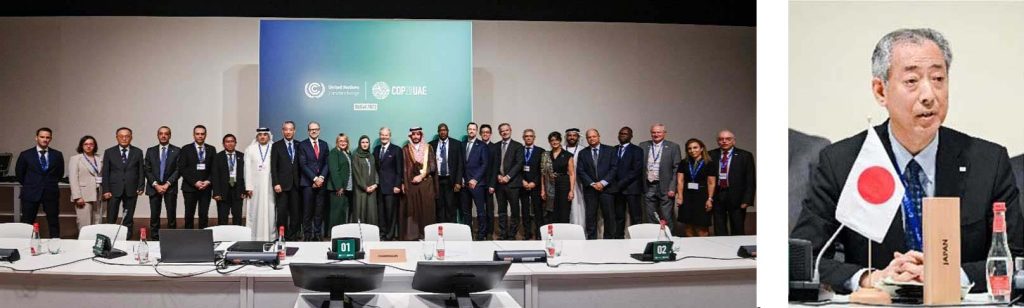
The 28th Conference of the Parties (COP28) to the United Nations Framework Convention on Climate Change was held in Dubai, United Arab Emirates (UAE), from November 30 to December 12, 2023. This 28th meeting focused on enhancing climate change mitigation efforts towards achieving the goals of the Paris Agreement.
The Japan Aerospace Exploration Agency (JAXA) participated in the COP from December 2 to 6, hosting side events and exhibitions. Additionally, seizing the opportunity presented by COP28, JAXA signed an agreement with the French National Centre for Space Studies (CNES) and held talks with the Brazilian Ministry of Environment and Climate Change.
● Space Agency Leader’s Summit (December 4)
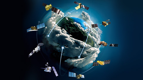
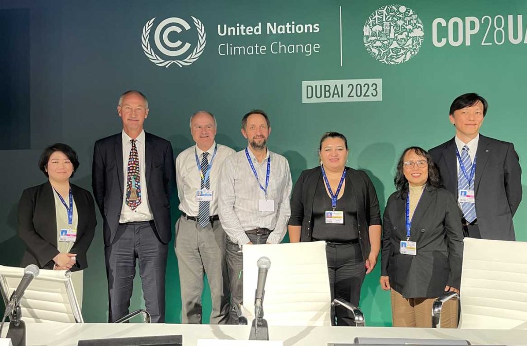
At the invitation of the UAE Space Agency, the Space Agency Leader’s Summit was held. The meeting, convened by the UAE Space Agency, aimed to declare the contribution of Earth observation to mitigating and adapting to climate change. JAXA’s President, Yamakawa, attended the summit and spoke on “the importance of Japan’s nearly 40-year commitment to the development and operation of Earth observation satellites, the need to continue observing Earth from space without interruption, and the importance of collaborating with international partners, various stakeholders, and the private sector to translate satellite-based Earth observations into effective action.” Additionally, space agencies from around the world, including NASA and ESA, made statements, and a declaration document titled “Pledge for Enhancing Space-Based Climate Initiatives” was compiled and adopted. The declaration highlights the importance of utilizing space technology in responding to climate change, the significance of comprehensive observation, data sharing, and the advancement of climate change research. The COP emphasized the contribution of space technology to climate change mitigation and adaptation measures and shared the importance of the role of Earth observation and international cooperation in continuous integrated observation at the space agency leader level.
Participating Space Agencies (in alphabetical order by country name):
Bahrain (National Space Science Agency), Canada (Canadian Space Agency, CSA), Egypt (Egyptian Space Agency), Europe (European Space Agency, ESA), France (French National Centre for Space Studies, CNES), Indonesia (National Research and Innovation Agency), Italy (Italian Space Agency, ASI), Japan (Japan Aerospace Exploration Agency, JAXA), Luxembourg (Luxembourg Space Agency), Norway (Norwegian Space Agency), Portugal (Portugal Space Agency), Republic of Korea (Korea Aerospace Research Institute), Republic of Zimbabwe (Zimbabwe National Geospatial and Space Agency), Russia (ROSCOSMOS), Rwanda (Rwanda Space Agency), Saudi Arabia (Saudi Space Agency), Sweden (Swedish National Space Agency), Singapore (Office for Space Technology & Industry), United Arab Emirates (UAE Space Agency), United Kingdom (UK Space Agency), United States (National Aeronautics and Space Administration, NASA) (Total 21 agencies)
● Hosting of Side Events
During the COP, numerous space-related and official UNFCCC side events were held at the Space Pavilion. Details about the JAXA-related events are available on the following website.
Week at Glance
| Date (UTC+4) | Event title |
| 2 December, 14:10-14:55 |
GHG measurements from space [Space Pavilion, Technology and Innovation Hub2, Green Zone] |
| 4 December, 13:00-14:00 |
Enhancing forest monitoring and management through innovative satellite solutions – to accelerate NDC implementation through REDD+ [Space Pavilion, Technology and Innovation Hub2, Green Zone] |
| 4 December, 14:30-16:00 |
Monitoring Methane from Space: Towards an Internationally Recognised Standard [Space Pavilion, Technology and Innovation Hub2, Green Zone] |
| 6 December, 11:30-13:00 |
Satellite Observation contributing to GHG inventory, NDCs, and GST [COP28 Official Side Event] |
| 6 December, 14:00-14:30 |
Technology and Innovation for Improving disaster risk knowledge: GEO &UNFCCC TEC join forces to support Early Warnings for All [Space Pavilion, Technology and Innovation Hub2, Green Zone] |
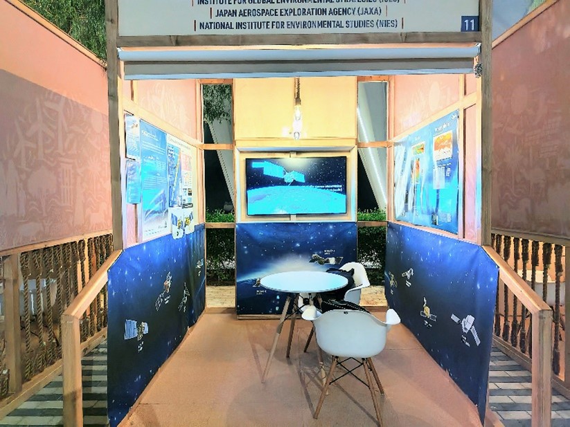
● Booth Exhibition
JAXA set up its own booth at the Space Pavilion, where it displayed its contributions to monitoring climate change through Earth observation satellites. Additionally, JAXA co-exhibited at the official UNFCCC exhibition booth with the National Institute for Environmental Studies and the Institute for Global Environmental Strategies (IGES).
[Space Pavilion JAXA Booth]
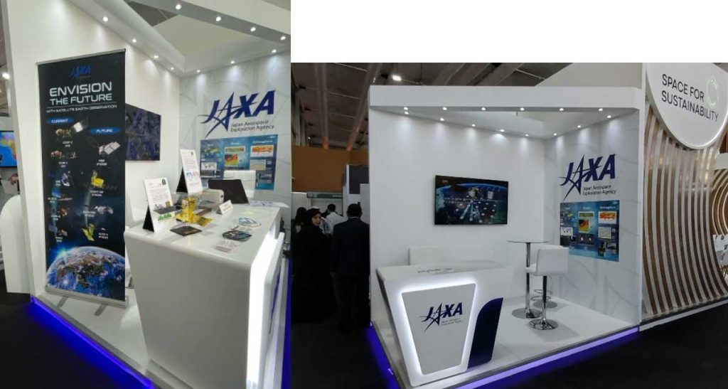
[UNFCCC exhibition booth]
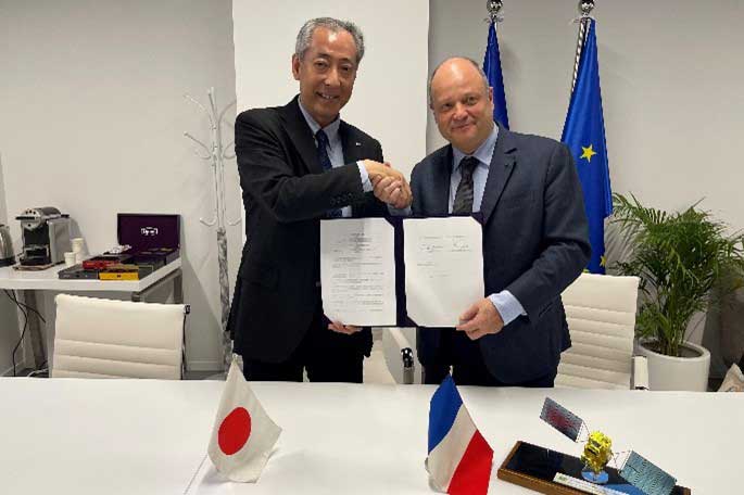
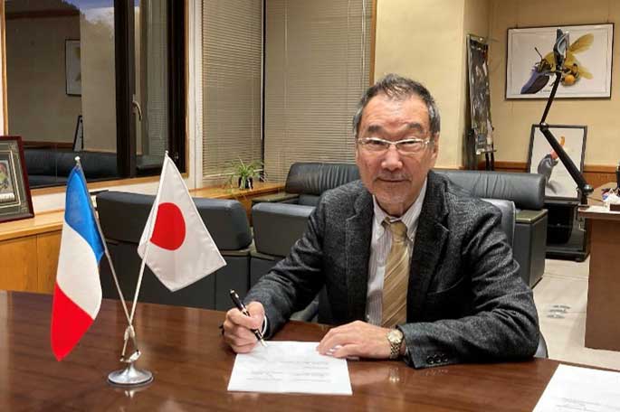
● Extension of Cooperation on the Greenhouse Gases Observing Satellite “IBUKI” Agreement Signed
The French National Centre for Space Studies (CNES), the Japan Aerospace Exploration Agency (JAXA), and the National Institute for Environmental Studies have extended their collaborative agreement, initially signed in 2017, for the Greenhouse Gases Observing Satellite “IBUKI” (GOSAT) and “IBUKI-2” (GOSAT-2), along with the METOP-mounted IASI and MicroCARB. This partnership focuses on mutual calibration of satellites and validation of data.
The recent agreement incorporates the upcoming GOSAT-GW satellite, scheduled for launch next fiscal year, into the cooperation framework and extends the partnership for an additional five years. Through this collaboration, both parties aim to enhance the accuracy of greenhouse gas observation data they possess. Furthermore, by promoting the use of these results, they seek to contribute to climate change mitigation and support the Paris Agreement and the Global Stocktake (GST).
This extended cooperation marks a significant step forward in the global effort to monitor and understand greenhouse gas emissions more accurately, thereby facilitating more effective climate action.
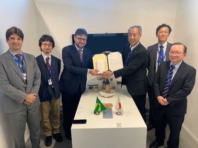
● Provision of Land Observation Technology Satellite “ALOS” Data to the Brazilian Ministry of Environment and Climate Change
JAXA provided data from the Land Observation Technology Satellite “ALOS” to the Brazilian Ministry of Environment and Climate Change, in response to their request to use the data as a reference for enforcing forest laws within Brazil. JAXA has collaborated with Brazil through the Japan International Cooperation Agency (JICA) and JAXA on projects such as the “ALOS” Image Utilization Project for Amazon Forest Conservation and Illegal Logging Prevention from 2009 to 2012, and the operation of the JICA-JAXA Forest Early Warning System in the Tropics (JJ-FAST) based on those results. Currently, JAXA is also cooperating in the monitoring of illegal deforestation through the “Project for Improvement of Illegal Forest Cutting Management in the Brazilian Amazon Using Advanced Radar Satellites and AI Technology” being conducted from 2021 to 2026. JAXA will continue to contribute to the conservation of the Amazon Basin forests through the efforts of the Brazilian government.
JAXA’s Activities at UNFCCC/COP28
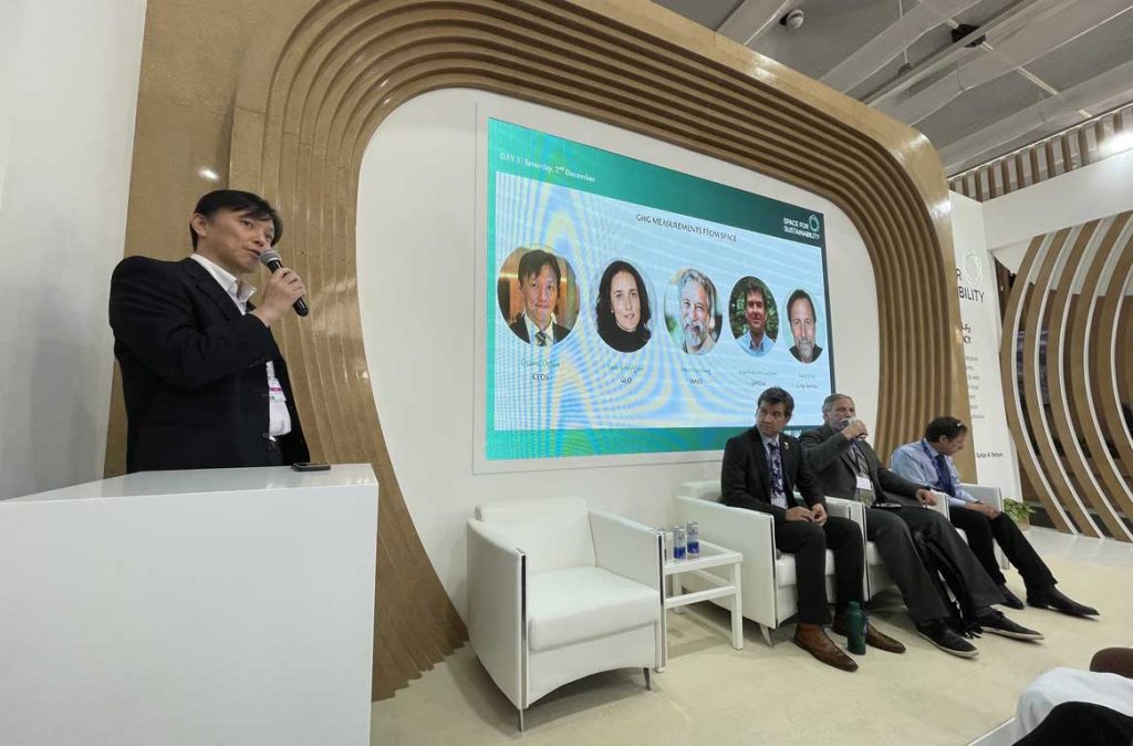
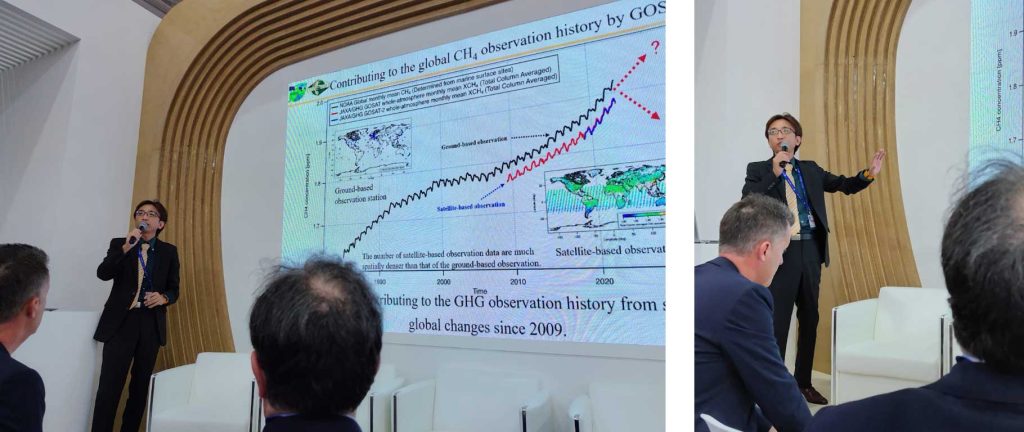
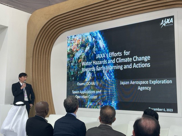
GHG Measurements from Space
On December 2, Osamu Ochiai from the Japan Aerospace Exploration Agency (JAXA) presented at the “GHG Measurements from Space” event. This event, organized by the Committee on Earth Observation Satellites (CEOS), the Group on Earth Observations (GEO), and the International Methane Emissions Observatory (IMEO), took place during the 28th session of the Conference of the Parties (COP28) to the United Nations Framework Convention on Climate Change (UNFCCC) in Dubai, UAE.
The event, primarily hosted by CEOS, focused on introducing and discussing new satellite missions for measuring carbon dioxide (CO2) and methane (CH4), as well as the application of their data to mitigation measures. This included engaging with fossil fuel infrastructure operators through IMEO. As the chair of the Strategic Implementation Team (SIT) of CEOS, JAXA coordinates the collaboration among national space agencies to conduct greenhouse gas (GHG) observations from space. Ochiai, representing both CEOS and JAXA, outlined the event’s objectives and emphasized three key points regarding the advancements in space-based GHG observations:
- Understanding and accurately measuring the current levels, trends, and sources of GHG emissions are fundamental to the implementation of the Paris Agreement.
- Better information leads to better-informed responses and outcomes. Data and information reporting by countries are integral to the Paris Agreement and the Global Stocktake (GST) process.
- Earth observation (EO) satellites are increasingly capable of monitoring GHG emissions with precision and scale, supporting policymakers at all levels.
In addition to the organizers CEOS, GEO, and IMEO, GHGSat, a Canadian company from the private sector, also participated in the event. They discussed the status and future prospects of GHG observation through public-private and international collaboration. JAXA plans to continue its GHG observation efforts by launching the Global Observing Satellite for Greenhouse gases and Water cycle (GOSAT-GW) in the future. This satellite will join JAXA’s existing series of GHG satellites, including the Greenhouse gases Observing SATellite “IBUKI” (GOSAT) and “IBUKI-2” (GOSAT-2), which are currently operational.
■ Speakers
– Osamu Ochiai, Japan Aerospace Exploration Agency (JAXA)
– David Crisp, Crisp Spectra LLC / Committee on Earth Observation Satellites (CEOS)
– Steve Hamburg, International Methane Emissions Observatory (IMEO)
– Jean-Francois Gauthier, GHGSat Inc
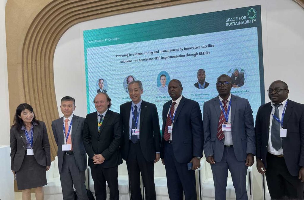
Enhancing Forest Monitoring and Management through Innovative Satellite Solutions – to Accelerate NDC Implementation through REDD+
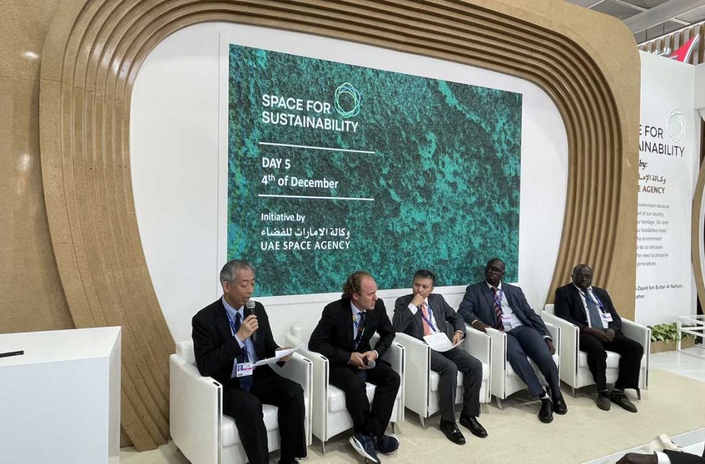
On December 4, the Japan Aerospace Exploration Agency (JAXA), in collaboration with the Japan International Cooperation Agency (JICA) and the Government of Kenya, organized the side event “Enhancing Forest Monitoring and Management through Innovative Satellite Solutions – to Accelerate NDC Implementation through REDD+” at the 28th session of the Conference of the Parties (COP28) to the United Nations Framework Convention on Climate Change (UNFCCC) held in Dubai, UAE.
The Paris Agreement mandates each country to submit a Biennial Transparency Report (BTR) to ensure the transparency of its Nationally Determined Contributions (NDC). Furthermore, under the Reducing Emissions from Deforestation and Forest Degradation in developing countries (REDD+), countries are preparing to report their results in the BTR Technical Annex. For this side event, representatives from Brazil, Mozambique, and Kenya were invited to share how they are utilizing satellite imagery in forest management and reporting on the results of the REDD+ policy approach.
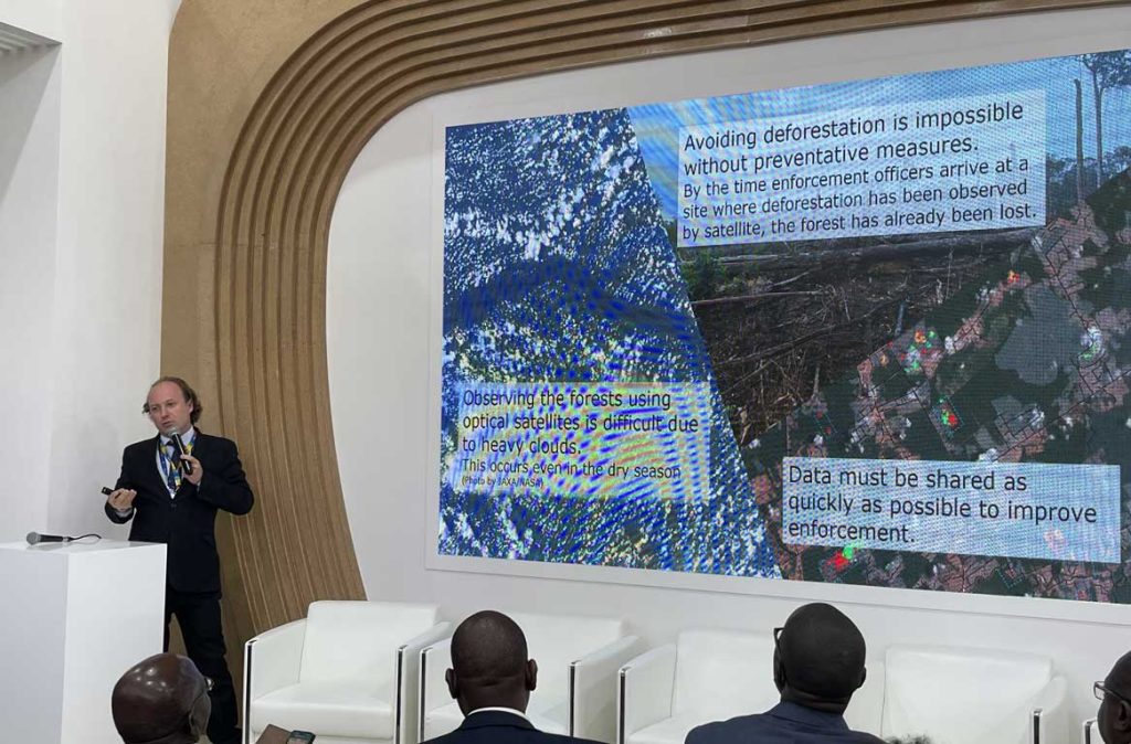
Following opening remarks by Hiroshi Yamakawa, President of JAXA, and Alexander Lemarkoko, Chief Conservator of Forests, Kenya Forest Service, the keynote address was given by Rodrigo Antônio de Agostinho Mendonça, President of the Brazilian Institute of Environment and Renewable Natural Resources (IBAMA). He highlighted IBAMA’s efforts to combat illegal logging by implementing five strategies aimed at achieving zero deforestation by 2030. These strategies include the use of data from both optical and radar satellites, as well as AI to predict areas of potential logging.
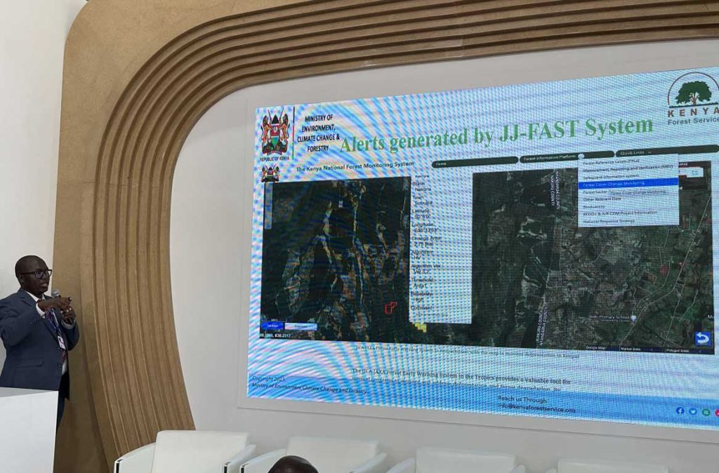
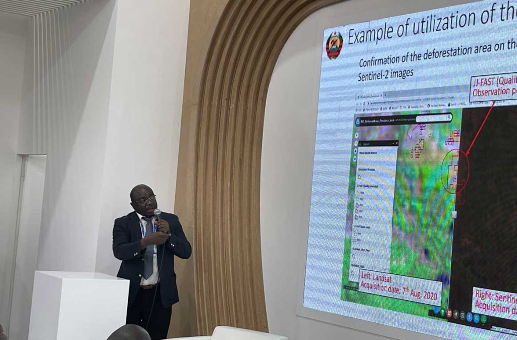
Mozambique reported on the development of the Satellite-based Deforestation Reference System (SDRS), which integrates multiple satellite information including the JICA-JAXA Forest Early Warning System in the Tropics (JJ-FAST), utilizing data from the Advanced Land Observing Satellite-2 “DAICHI-2” (ALOS-2), to obtain reference information on deforestation due to logging and fires. Kenya also shared their development of the Forest Alerts System using JJ-FAST, which aids in detecting forest changes and fires.
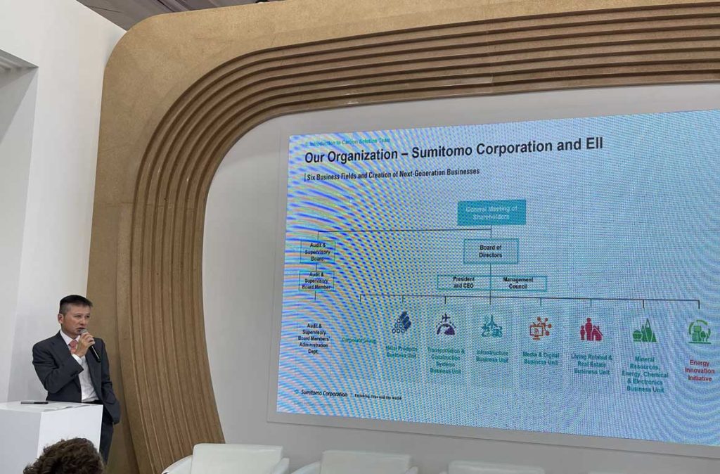
The event concluded with a presentation by Sumitomo Corporation, a private company addressing climate change and deforestation issues. They discussed their involvement in the carbon credit market and the application of JAXA’s Global Mangrove Map for their projects.
This event facilitated the exchange of practical information on forest monitoring activities utilizing satellite technology, with contributions from various countries and sectors. JAXA remains committed to supporting forest monitoring efforts in different countries through satellite observations, thereby enhancing forest management capabilities.
■ Speakers
– Hiroshi Yamakawa, Japan Aerospace Exploration Agency (JAXA)
– Alexander Lemarkoko, Kenya Forest Service (KFS), Government of Kenya
– Rodrigo Antônio de Agostinho Mendonça, Brazilian Institute of Environment and Renewable Natural Resources (IBAMA)
– Joaquim Macuacua, National Directorate of Forests, Ministry of Land and Environment, Government of Mozambique
– Richard Mwangi, Kenya Forest Service (KFS), Government of Kenya
– Manabu Kido, Energy Innovation Initiative, Sumitomo Corporation – Moderator: Yasuko Inoue, JICA SFS-CORECC Project, Kenya
■ Event Flyer
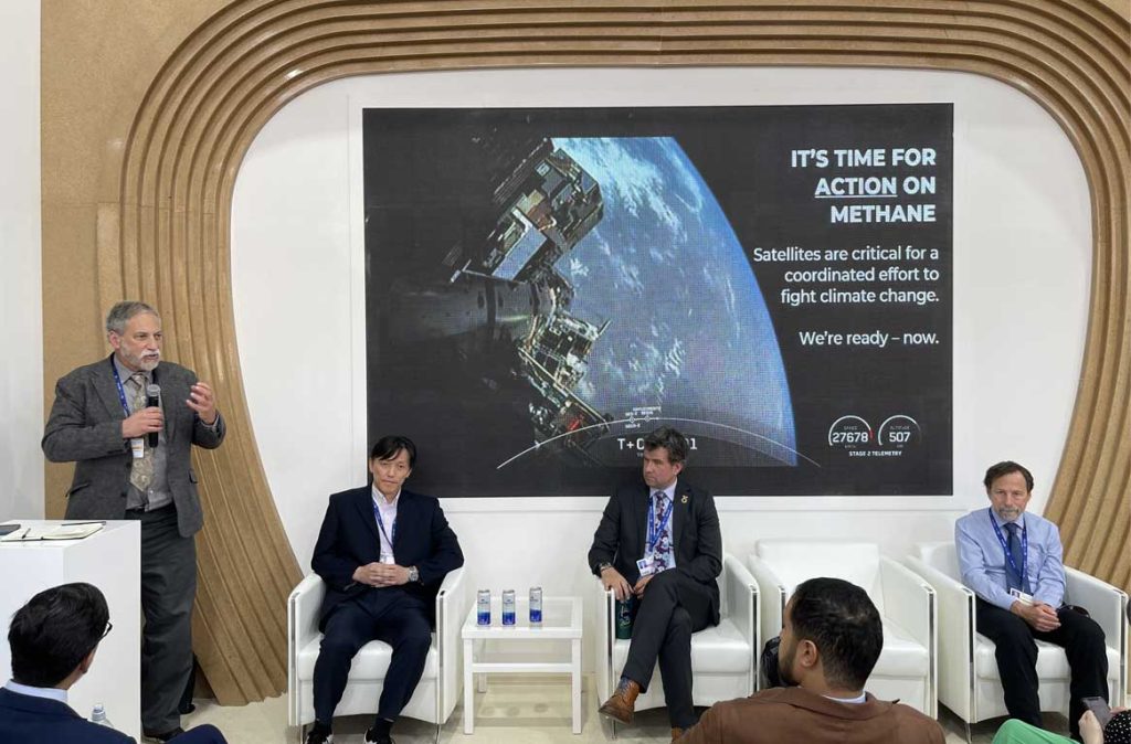
Monitoring Methane from Space: Towards an Internationally Recognised Standard
On December 4, Hiroshi Suto of the Japan Aerospace Exploration Agency (JAXA) spoke at the event “Monitoring Methane from Space: Towards an Internationally Recognised Standard,” organized by the UK Space Agency (UKSA) during the 28th session of the Conference of the Parties (COP28) to the United Nations Framework Convention on Climate Change (UNFCCC) held in Dubai, UAE. The event focused on methane (CH4), one of the most impactful greenhouse gases (GHG), to share and discuss current activities and the path forward for establishing internationally recognized methane standards for effective climate action. JAXA and the European Space Agency (ESA) represented space agencies in the first half of the event, while GHGSat (Canada) and Kayrros (France) represented private companies in the second half, introducing the status of their satellites and future plans.
Suto presented the results of 14 years of methane observations from the Greenhouse gases Observing SATellite “IBUKI” (GOSAT) and “IBUKI-2” (GOSAT-2), which are currently operational. He highlighted that satellites are a crucial tool for understanding the spatial and temporal changes in methane concentrations. He further explained that the GOSAT series contributes to estimating regional methane emissions, as these satellites can also measure the vertical distribution of methane concentrations.
The event underscored the differences between space agency satellites, which observe the entire globe, and commercial satellites, which target specific areas. Given the distinct characteristics of the observation data obtained from these sources, the development of internationally recognized standards is essential for combining and utilizing various types of satellite data effectively.
JAXA is committed to continuing its GHG observations by launching the Global Observing SATellite for Greenhouse gases and Water cycle (GOSAT-GW) in the future and will engage in ongoing discussions with related organizations about the standards for observation data. This effort aims to contribute significantly to measuring methane emissions using satellite technology.
■ Speakers
– Harshbir Sangha, UK Space Agency (UKSA)
– Beth Greenaway, UK Space Agency (UKSA)
– Paul Palmer, University of Edinburgh/Natural Environment Research Council (NERC)
– Hiroshi Suto, Japan Aerospace Exploration Agency (JAXA)
– Simonetta Cheli, European Space Agency (ESA)
– Dan Wicks, GHGSat Inc
– Antoine Halff, Kayrros SAS – Paul Green, National Physical Laboratory (NPL)
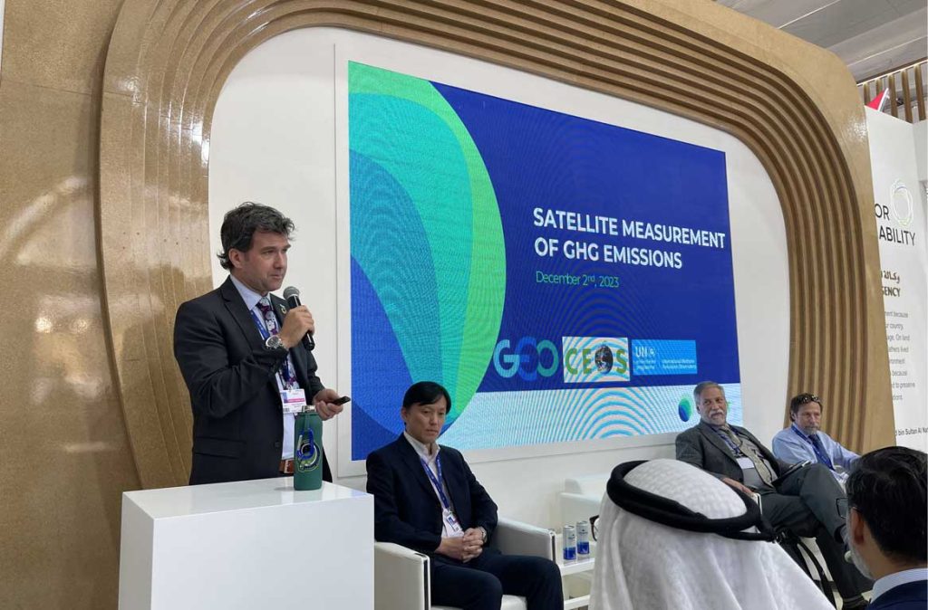
Official Side Event “Satellite Observation Contributing to GHG Inventory, NDCs, and GST”
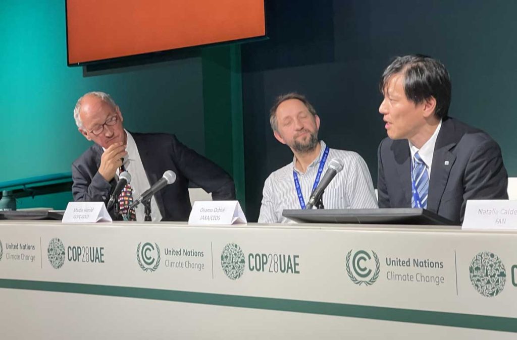
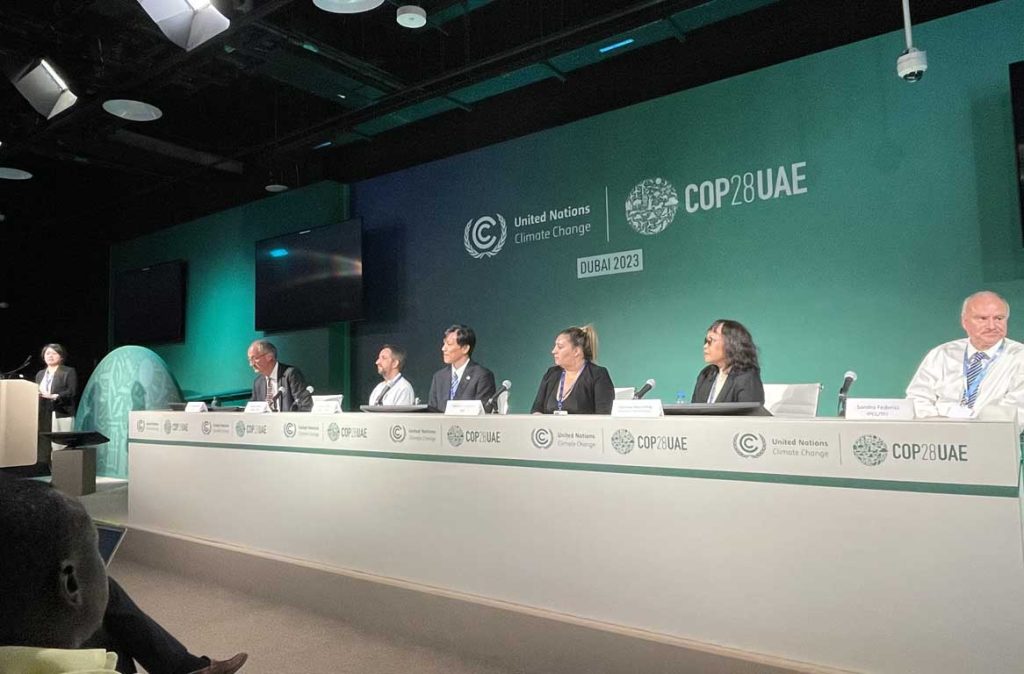
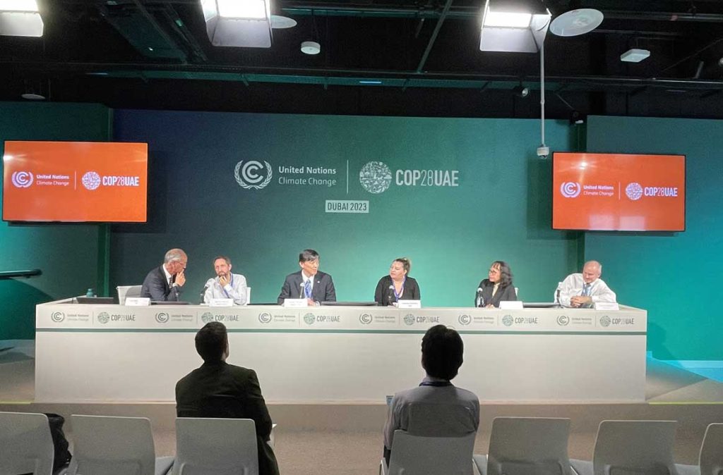
On December 6, the Japan Aerospace Exploration Agency (JAXA), in collaboration with the European Space Agency (ESA), the Remote Sensing Technology Center of Japan (RESTEC), and the German Research Centre for Geosciences (GFZ) Helmholtz Centre Potsdam, organized the official side event “Satellite Observation Contributing to GHG Inventory, NDCs, and GST” at the 28th session of the Conference of the Parties (COP28) to the United Nations Framework Convention on Climate Change (UNFCCC) held in Dubai, UAE.
A key component of anthropogenic Greenhouse Gas (GHG) emissions is “Agriculture, Forestry, and Other Land Use (AFOLU),” with a particular emphasis on understanding forestry. Due to its vast area, accumulating numerical values measured on the ground is challenging, but Earth observation satellites offer an efficient and continuous monitoring solution.
The event commenced with presentations from space agencies providing satellite data and institutions utilizing this data for capacity building. They reported on the current status of systematic observations by national space agency satellites and improvements in forest monitoring capacity within various countries. Osamu Ochiai, representing JAXA as the chair of the Strategic Implementation Team (SIT) of the Committee on Earth Observation Satellites (CEOS), discussed future perspectives of the satellite observation network, upcoming international activities utilizing satellites, and plans for biomass mapping using satellite data to be implemented in Japan.
Following this, success stories of forest management using satellite data were shared, with case studies from Bolivia and the Philippines highlighted. Notably, the Philippines successfully identified forested areas that had been overlooked in the land use/land cover map produced by the National Mapping and Resource Information Authority (NAMRIA) using the “Forest/Non-Forest Map” generated from data acquired by JAXA’s Advanced Land Observing Satellite-2 “DAICHI-2” (ALOS-2). It was also revealed that the country’s GHG inventory had been underestimated and that the Philippines had the potential to absorb nearly twice as much CO2 as currently reported. Additionally, Sandro Federici from the Technical Support Unit (TSU) of the IPCC’s Inventory Task Force (TFI) presented an overview of software created and released by the IPCC for calculating inventories.
Despite technical challenges, Bolivia and the Philippines have made significant strides in introducing satellite technology with support from developed countries. This side event served as a platform to share success stories and lessons learned among participants.
Leveraging this opportunity, JAXA aims to promote the adoption of satellite data in other countries and regions, thereby enhancing the efficiency of inventory preparation.
■ Speakers
– Frank Martin Seifert, Earth Observation Programme Directorate, European Space Agency (ESA)
– Martin Herold, the German Research Centre for Geosciences (GFZ) Helmholtz Centre Potsdam
– Osamu Ochiai, Japan Aerospace Exploration Agency (JAXA)
– Natalia Calderon, Fundación Amigos de la Naturaleza (FAN)
– Damasa Macandog, University of the Philippines Los Baños
– Sandro Federici, Technical Support Unit (TSU) of the IPCC’s Inventory Task Force (TFI) – Moderators: Mariko Harada, JAXA / Frank Martin Seifert, ESA
■ Event Flyer
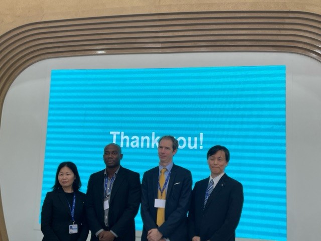
Technology and Innovation for Improving disaster risk knowledge: GEO &UNFCCC TEC join forces to support Early Warnings for All
The United Nations Framework Convention on Climate Change’s Technology Executive Committee (UNFCCC TEC), JAXA, and the Group on Earth Observations (GEO) held a side event focusing on the role of space technology and satellite imagery in enhancing disaster risk management and climate change resilience, incorporating perspectives from Small Island Developing States. The event offered insights from the ongoing cooperation under the ‘Early Warnings for All’ initiative (EarlyWarning4All) by UNFCCC TEC and GEO. It introduced tools and technologies that can assist developing countries in formulating and implementing science-based climate policies, plans, and funding proposals. The ‘Climate Risk and Early Warning Systems (CREWS) Initiative’ Secretariat presented its mechanism for providing funding to Least Developed Countries (LDCs) and Small Island Developing States (SIDS) for building early warning systems based on risk information.
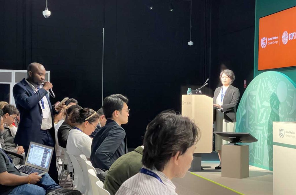
Osamu Ochiai of JAXA spoke about how satellite data contributes to reducing the damage caused by extreme weather events and heavy rains, which are challenging to predict in island nations and developing countries. Specifically, the contribution was highlighted through the provision of the ‘Global Satellite Mapping of Precipitation (GSMaP)’ to the CREWS Initiative, combining data from Japanese satellites with those from Europe and the United States to understand global precipitation conditions. This effort supports the ‘Early Warnings for All’ (EW4All) initiative. The availability of these data, which are freely accessible online, sparked questions from participants, with many noting the website URL for access.
■ Speakers
– Lennox Gladden, United Nations Framework Convention on Climate Change (UNFCCC) / Ministry of Sustainable Development, Climate Change and Disaster Risk Management, Belize
– Rui Kotani, GEO Secretariat
– John Harding, Climate Risk and Early Warning Systems (CREWS) Secretariat – Osamu Ochiai, JAXA
Organized by: Group on Earth Observations (GEO), Secretariat of the United Nations Framework Convention on Climate Change (UNFCCC)
Search by Year
Search by Categories
Tags
-
#Agreement
-
#Application
-
#Award
-
#Climate
-
#DAICHI (ALOS)
-
#DAICHI-2 (ALOS-2)
-
#DAICHI-3 (ALOS-3)
-
#DAICHI-4 (ALOS-4)
-
#Disaster Management
-
#EarthCARE/CPR
-
#Education
-
#GOSAT-GW
-
#GPM/DPR
-
#HIMAWARI
-
#IBUKI (GOSAT)
-
#IBUKI-2 (GOSAT-2)
-
#KIZUNA (WINDS)
-
#SHIKISAI (GCOM-C)
-
#SHIZUKU (GCOM-W)
-
#Tour and Exhibits
-
#TSUBAME (SLATS)
Related News
- Event 2023.12.01 Fri
- Event 2023.03.30 Thu
- Event 2022.06.13 Mon
- Event 2017.11.02 Thu
- Event 2017.10.27 Fri


